Wild Camping in Galloway Forest Park
Posted on Saturday, 18th June 2011
I started writing this as a post about startrail photography, but my verbosity got the better of me and I ended up at about 2000 words — mostly describing the trip. So I decided to split the posts and do one dedicated to our wild-camping trip so that I could keep the photography post more focussed…
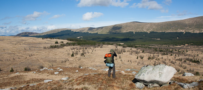
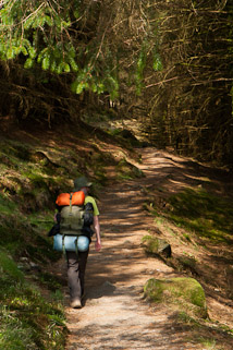
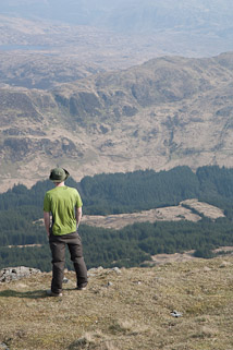
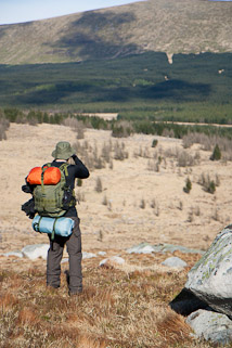
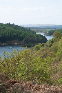
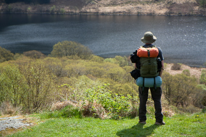
One night, a friend (the guy pictured in the images) and I were in the local pub, several pints into the evening, and we started discussing a hypothetical wild-camping trip. We decided there and then to take a trip to Galloway Forest Park, where we could hike across the remote wilderness and camp where we wanted thanks to Scotland’s access laws.
I had another motivation for choosing Galloway: that it was a Dark Skies park and I wanted to attempt some startrail photography (more on that in the next post!).
After weeks of planning and preparation, we set off into the hills of the Southern Uplands from the car park by Loch Trool. For our first day, we planned a route to Merrick, the highest mountain in the Southern Uplands at 843m. We would walk the long way around, via lochs between The Range of The Awful Hand and the southern end of The Dungeon Hills — they all sound very imposing, dont they? Finally, we would ascend Merrick via Redstone Rig and press on a short way to set up camp for the night between the peaks of Merrick and Kirrereoch Hill.
Lost
We strode off confidently from the car, taking in the amazing views and trying to get some distance under our belts. We’d noticed that our route was even signposted at this point. “This is easy!” However, when the path met a footbridge, I was a little confused: we weren’t due to cross a footbridge. We checked the map and spotted a footbridge and figured we had strayed a little off-track. As we continued, I was checking the map and taking bearings. It didn’t seem to add up. A bit more surveying the landscape and we realised the embarrassing truth: we were lost! After half an hour!
This didn’t bode well for a four-day excursion into some of the wildest, most remote territory Little Britain has to offer.
We started up the nearest hill, to gain some altitude and a better view of the landscape. During our ascent I managed to determine our location: we had missed our turn-off on the trail almost 2km back and had ended up in the adjacent valley.
What to do? We could carry on up the hill and over to reach Loch Valley and eventually meet back up with our trail; we could backtrack to the point where we made a wrong turn.
As part of our planning, we had allowed for an alternative, shorter route up the main hiker’s path to the peak of Merrick via Benyellary, just in case we arrived late, or weather was an issue on the first day. It was fortunate that we had the back-up plan. We decided that the best thing to do was to backtrack to the start (!) and go with the alternative route. We had wasted time and we didn’t know what lay ahead and we needed to reach our campsite before sundown. We went with the option we knew we could achieve, that would rescue our first day and the success would boost our morale. So, we stopped for lunch and headed back to the start point. By the time we were starting-off on the hiker’s trail, we had already wasted three hours!
First Camp and a Sleepless Night
The weight of the bags we were carrying — four days’ worth of food, cooking equipment, sleeping bags, tent, clothes, a DSLR, and a tripod — had made the constant ascent from Loch Trool to the peak of Benyellary a very tiring walk indeed. But, the views along the way were spectacular. Taking in the awesome scene across the valley to The Dungeon Hills and beyond had made it all worth it.
The last few hikers passed us on their way down from Merrick, and we were now alone in the hills. We pressed on to Merrick, admired the vista once more, and descended along Little Spear to our first wild campsite — some 637m above sea level.
Dropping our gear on a nice flat, dry, spot where we would pitch the tent, we headed off to find a water source. We happened across a small waterfall that provided us with probably the cleanest, tastiest, water we would drink for the entire trip. We were feeling good. Our spirits were high. We had conquered the mountain and it was time to settle down for the evening.
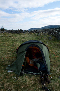
But the hills had other ideas, and this is when they began to bite back. The wind picked up and it quickly dawned upon us how exposed our chosen spot was. Just putting the tent up was nearly impossible! The next fifteen minutes or so were spent on a recce of the surrounding area to find a more protected spot. The biggest problem was that most of the flat ground was completely waterlogged! Eventually, we found a nice little spot adjacent to a small rocky outcrop and pitched. The wind died down and we got on with the evening routine of making a brew and our dinner.
Our Be Well Expedition Foods, by the way, were surprisingly good: lightweight (freeze-dried), very easy to prepare (add boiling water), filling, and exceedingly tasty. Highly recommended.
Bedding down with full, satisfied, bellies, the weather took a turn for the worse. The wind battered the tent in every direction. Driving rain was belting down upon the flysheet and managing to encroach into our porch area. Unknown to each other, we were both lying there, wide awake, just waiting for the tent to collapse and for this adventure to become an epic on the very first night. It didn’t, and the next morning the tent was still standing. My friend’s boots were completely soaked through though!
Into the Wild
The next day, after late start due to sleeplessness and rain, we set off on our route to our next destination. Now, we were off-trail and in some of the remotest terrain in the country. This is what we had come for.
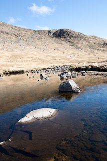
By lunchtime, when we stopped for lunch at a picturesque kink in the Eglin Lane river, the morning drizzle had passed and we were enjoying beautiful sunshine that would last for the rest of the day. The only sounds were the gentle trickle of the water, coursing its way down the valley towards the north, and the occasional groan from some creature we couldn’t locate. There was not another human being to be seen or heard.
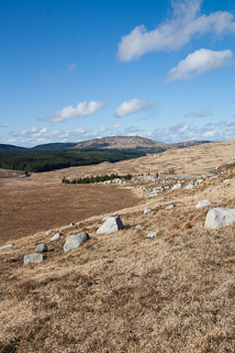
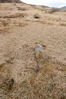
One factor we hadn’t anticipated was exactly how difficult the terrain would be. On the map the terrain was indistinguishable from nice flat grassland. In reality, the flat areas were the worst! The entire valley was carpeted with horribly huge tussocks, often growing on peaty, boggy, wet ground. It was a lot tougher and more tiring than we had expected.
As the going was slow we had decided to head straight for the campsite, rather than head further north to Loch Doon before doubling-back, as planned. As much as we had planned this trip, maps and research couldn’t prepare us for what it was actually like, so we were learning a lot on the go, which was part of the fun and adventure.
As we headed north through the valley, our day was brightened by the sight of a family of deer grazing atop the Milmore. This was out first sighting of some real British wildlife other than the sheep wandering around our previous evening’s campsite. My camera was packed in the bottom of my bag at this point to protect it from the rain which had only just relented. They were gone before I could decide to capture them.
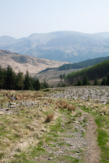
We made decent time, for the conditions, and as we ascended and rounded the lower slopes at the northern end of The Dungeon Hills we were presented with more stunning sights across the forest of the Gala Lane valley over to the Rhinns of Kells. We thought the terrain had been bad, so far — but the terrain to come was even worse! The land we were about to cross had been forested and felled. As such it was crossed with irrigation canals, roots, fallen logs, and those terrible, tortuous, tussocks. I was tiring, almost falling over on several occasions, and my morale was starting to drop. I was just wanted to reach camp. But, upon reaching a fence along a firebreak in the forest, my mood was lifted as we spotted another deer making a dash for the tree-line. It was a beautiful sight; it would have made a wonderful picture: a deer between the trees with a clear view down to the river, with forest and mountains for a backdrop. Alas, the skittish doe was too fast for me and my camera was still hanging at my side by the time she had vanished into the dark, safe shelter of the forest.
Fore Starr under four billion stars (and the rest)
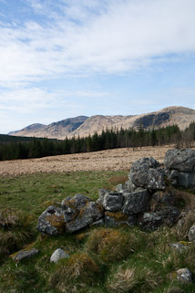
Our planned campsite for the second night was a location named “Fore Starr”. We had spotted this whilst pored our trusty Ordnance Survey Explorer map, wondered what it was, and fired up Google Earth for some more detailed reconnaissance. It looked like a ruined building. We thought it might make an interesting place to stay, and I thought it might include some interesting scenery for my planned star trails shoot.
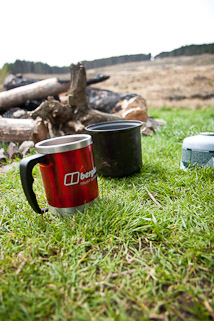
We arrived relieved after a tough day of yomping across the unexpectedly difficult terrain and were very pleased with the beauty of the location. We collected some firewood — fortunately there was a recently felled area of forest nearby with plenty of discarded wood for us to plunder — and some ominously green-tinted water, made camp, and began the evening routine.
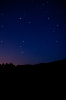
We were very lucky this evening: the sky was completely clear. It couldn’t have been more perfect. The sky turned a wonderful inky blue as the last hints of daylight receded. We got our fire going, had a brew, and ate our rehydrated freeze-dried meals.
Eventually, blue hour passed and we began to discover how Galloway Forest Park achieved its dark skies status. Complete darkness; a pitch black sky pierced only by the ancient light emitted by thousands of stars that, due to living in a big city these days, I hadn’t seen since I was a teenager.
We spent a long time simply staring at the stars, picking out constellations, seeing shooting stars burn up in the atmosphere. At one point, a very bright, large, light crossed the sky at an incredible rate. It could not have been an aeroplane. It didn’t appear to be a shooting star. Our best guess was that it was the International Space Station, passing over in orbit high above us.
I got to try out my startrails image whilst my friend bedded down to listen to his iPod, eventually hitting the sack myself when the temperature dropped so low that condensation was instantly freezing. I think we both had a much better sleep that night, without the wind and the rain battering us. We only had the cold and the strange calls of an unknown beast circling our campsite to concern us.
The Dungeon Hills
The itinerary for day three was a hike through The Dungeon Hills. Starting in the north, we’d planned to cross Hooden’s Hill, Mulwarchar, Dungeon Hill, and Craignaw, before ending up on Craiglee to camp. This was due to be the toughest day that we had planned. However, knowing how tough the terrain had been and the knowledge of how much ground we were managing to cover, we knew that completing this route was very unlikely. We had planned that in case of bad weather we would descend back into the valley to the west if we needed to, so we set off to do some of the Dungeon Hills range with the intention that we would use the backup plan again, aim for Loch Enoch and either camp there or push on further if we had time.
It took us a while to reach the foot of the hills, retracing our steps through the difficult ground we had passed the previous evening. Once there, we got to business ascending Gordon’s Loup and the Wolf Slock. Again, enjoying the amazing views all around us: north to Loch Doon; south-east along the valley below the Rhinns of Kell; and west to Loch Macaterick.
After a particularly steep section, the terrain flattened out, and I boldy marched forward, looking around at the views around me. Then my leg disappeared from under me. I was falling forward, propelled by the weight of my rucksack and I was completely unbalanced. The lovely flat ground I’d seen as I crested the hill wasn’t solid at all. It was a very well disguised bog that had about a foot of water floating on top of it, topped-off with a carpet of grass inviting you to walk confidently over. I had to take another big step to catch my balance, otherwise I was going in face-first — not a great prospect considering it would mean being submerged in water, sinking into a bog, with around 20kg strapped to my back. I stopped, somehow managing to stay upright, and looked back. I was quite far in, out of reach. This could be bad. I’d already sunk to my crotch, but the bog was probably only up to the knees. Fortunately, it was not difficult to extricate myself. My legs came out relatively easily and we had a good laugh about my predicament.
The rest of the journey was relatively uneventful. After a walk along Hooden’s Hill that seemed to last a lot longer than the distance suggested, we descended into the valley and to the river for another picturesque lunchtime. We decided to abandon the rest of the range and head directly south to Loch Enoch and find a campsite in that area when the sun began to set. We felt like we’d made really good progress that day, and the sight of Loch Enoch as we topped the hill at its northern edge was another moment of pleasing relief.
Shortly thereafter, we bumped into a couple of guys, who we suspected may be poachers, fishing by the lake — they were the first human beings we had seen since the peak of Benyellary over 48 hours ago. The feeling of isolation in this place is incredible.
Skirting around the lake, we were getting increasingly conscious of the falling light levels. We needed to find a campsite, soon. It didn’t take too long before we had scouted out a perfect little campsite in a depression atop the Rig of Loch Enoch. We were very pleased with this pitch as we had found it on the go, in a hurry, with no previous planning or research, and it was wonderful. It was protected, dry, and had a great view — until the mist rolled down off Merrick and completely enveloped us!
Goodbye Galloway
Our final day started at a decent hour for the first time on the trip. We had got into a good routine, sorted ourselves out and broke camp shortly after breakfast. We had a relaxed walk back through the valley, through the forest towards Loch Trool, stopping for a brew at the Culsharg Bothy. We had time to reflect on the trip, to discuss what had went well and what had gone wrong could be done better. It was another beautiful, scorching hot day too.
We reached the car and drove out of the forest to the lovely little House o’ the Hill Hotel for a pint and some lunch. The Game Casserole and Sticky Toffee Pudding went down very well, washed down by a pint of Asahi. I’d recommend this place as a good way to end a similar trip in Galloway Forest Park — or perhaps even use as your base if you aren’t going to be camping out in the wild.
Overall, it was a fantastic trip that I enjoyed very much. We learned a lot from the experience and it left us with a desire for more. I’ll definitely be back to Galloway in the future.
